01 — Spatial Analysis Maps
Cartographic outputs from the ArcGIS / ArcSWAT workflow.
Watershed delineation, terrain characterization, and hydrologic response unit (HRU) analysis of the Haro River Basin using ArcSWAT, ArcGIS and Google Earth Engine — supporting catchment-scale water resource modeling and land-management decisions.
Cartographic outputs from the ArcGIS / ArcSWAT workflow.
Land use, soil composition, and sub-basin area extents.
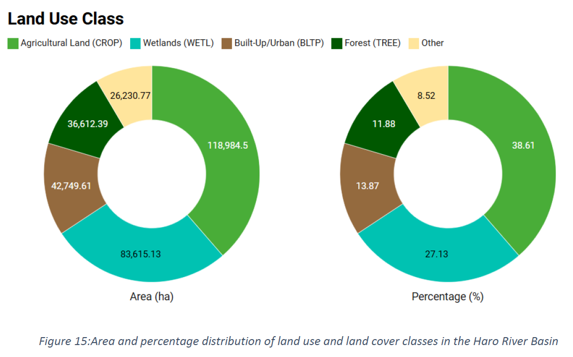
Area and percentage distribution of land use and land cover classes in the Haro River Basin.
Bar and percentage for LULC class across the basin.
Bar and percentage for soil types (Al002 and Al003) across selected sub-basins of the Haro River Basin. Al002 percent and its Al003 (sandy loam) percentage split.
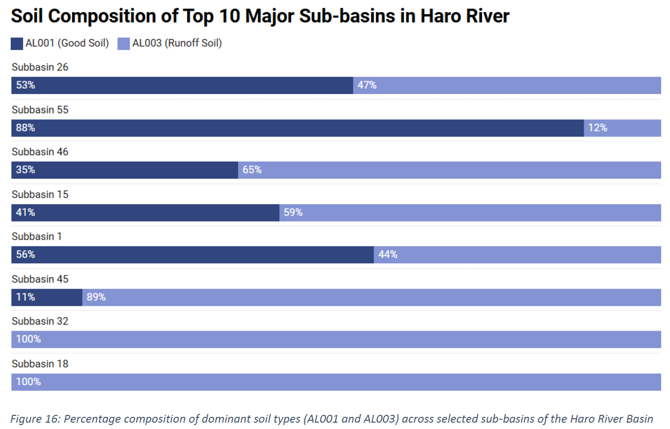
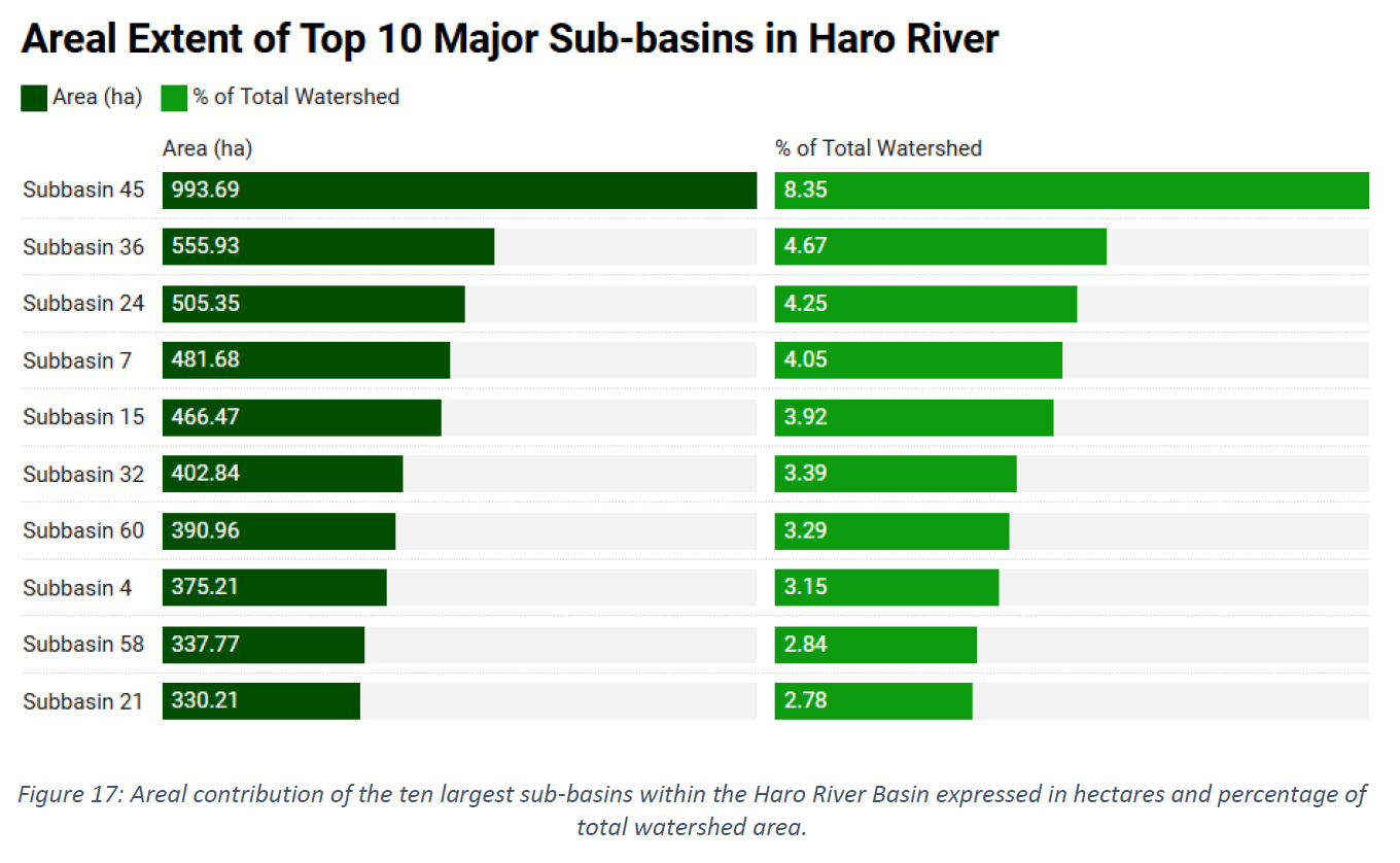
Absolute area and % of total watershed for the ten largest sub-basins, with both tabular and visual bar representation.
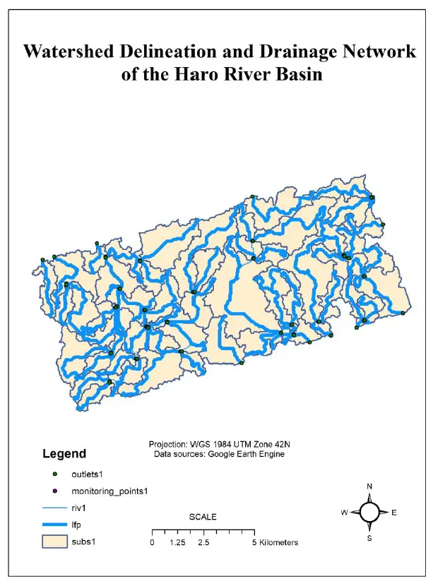
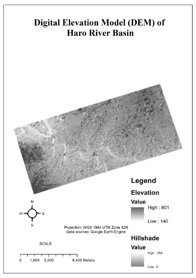
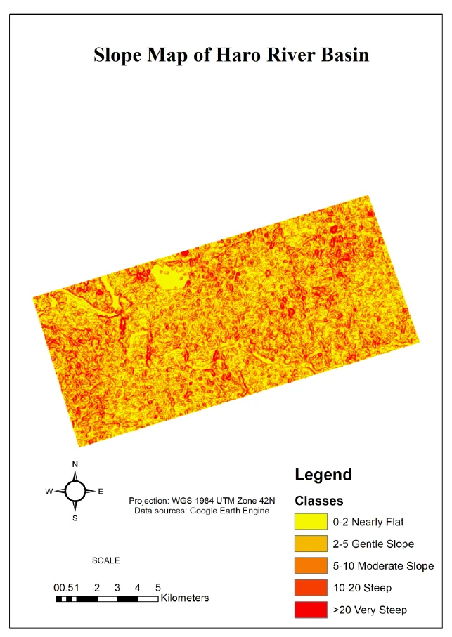
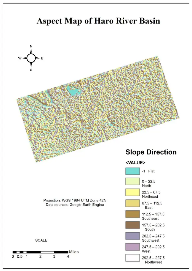
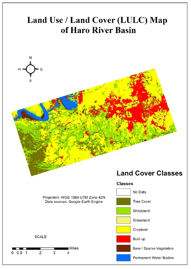
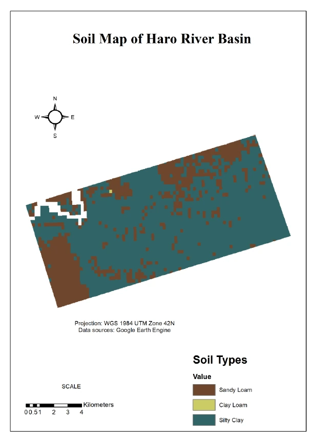
The Haro River Basin was delineated into 854 sub-basins using SRTM-derived DEM data, with drainage networks, slope gradients, and aspect maps produced via ArcSWAT. Terrain analysis reveals predominantly gentle-to-moderate slopes punctuated by steep zones, while LULC mapping shows agricultural land (38.4%) and wetlands (21%) as the dominant cover types. Soil mapping is dominated by Silty Clay with significant Sandy Loam patches — directly influencing runoff potential at the sub-basin level. Hydrologic response units integrate slope, soil and land-use into a cohesive modelling framework for downstream water-yield and sediment transport simulations.